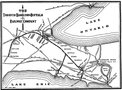
The map shows the state of the railway as of 1954 (click on the map to see the large-scale version):
|
This was the furthest extension of the railway (except the brief TH&B Navigation Company).
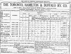
The following graphic shows the TH&B's half-page listing in the ORER of 1951:
 |